Georoute Röcknitz: “Röcknitz Trail of Stones”

- 0:40 h
- 2.68 km
- 15 m
- 15 m
- 117 m
- 133 m
- 16 m
- Start: Geoportal Röcknitz, An der Wasserburg 1-3, 04808 Thallwitz, district Röcknitz
- Destination: Geoportal Röcknitz, An der Wasserburg 1-3, 04808 Thallwitz, district Röcknitz
Röcknitz (Rokenitz, Rokytnica: "place where willows grow") and Treben (Drewan, Drevane: "people at the wood") have been united as one place since 1936. Elbe Germans, Slavs, and from the 12th century German settlers settled here. Around 287 million years ago, the region experienced massive volcanism that left a huge volcanic collapse crater (Wurzen Caldera) over a period of two million years. The volcanic rocks quartz porphyry – shaped by water, wind, and ice in later geological epochs – are unmistakable as the Hohburg Mountains. Humans have used the rock as a building material for over 500 years. Industrial quarrying began in 1887 at the Röcknitz Steinberg: The economic upswing at that time was titled "From stone came bread," during which the farming village also transformed into a quarry workers’ village.

Good to know
Best to visit
- suitableDepends on weather
Directions
The georoute "Röcknitz Trail of Stones" starts at the Geoportal Herrenhaus Röcknitz. The path goes straight ahead on the street "An der Wasserburg" to the former quarries on the Steinberg. Then it goes left past the private railway track. At the next intersection, turn right and then right again onto the main street. Pass the Steinbach Canal to the roundabout. There stands the memorial stone for the quarry industry.
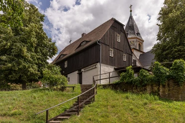
The first exit of the roundabout onto Lindenstraße leads to St. Nicholas Church. The second exit onto Thammenhainer Straße leads to the former residential house of the quarry director.
Coming from the main street, before the roundabout turn right onto the street "An der Feuerwehr." This path leads back to the starting point at the Geoportal.
Tour information
Cultural Interesting
Loop Road
Stop at an Inn
Equipment
Sturdy footwear or sports shoes.
Directions & Parking facilities
- Getting there
By car from Leipzig via the B87 to Röcknitz.
ParkingParking lot at the Geoportal Röcknitz
Public transportation- Bus 671: Zwochau - Röcknitz - Böhlitz - Thallwitz
- Bus 675: Falkenhain - Zwochau - Röcknitz - Thallwitz - Nischwitz - WurzenSchedule information at www.mdv.de
Additional information
Geoportal Röcknitz - Visitor center for supervolcanism in the Geopark Porphyrland
https://geopark-porphyrland.de/geoportal/geoportal-roecknitz/Author
Geopark Porphyrland. Steinreich in Sachsen
Organization
LEIPZIG REGION
License (master data)
Geopark Porphyrland. Steinreich in Sachsen

Author´s Tip / Recommendation of the author
Be sure to visit the new exhibition "Supervolcanoes in Saxony" at the Geoportal Röcknitz beforehand; accessible from September 2024
Explorer tip: Geoportal Herrenhaus Röcknitz
Nearby
Download GPX file