Kohlhaas Trail


- 2:30 h
- 10.15 km
- 9 m
- 9 m
- 86 m
- 91 m
- 5 m
- Start: Landscape Museum of the Düben Heath, Burg Düben
- Destination: Landscape Museum of the Düben Heath, Burg Düben
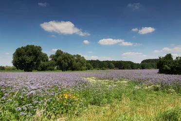
The Kohlhaas Trail is a circular route through the Mulde floodplains near Bad Düben. It is dedicated to the regional historical events surrounding the merchant Hans Kohlhase. The Kohlhaas Trail winds for over ten kilometers through the rural, idyllic landscape and a wetland with its special flora and fauna.
With the current project of the Landscape Conservation Association of Northwest Saxony e.V., the original route guidance has been supplemented with numerous information about Natura 2000. In particular, it focuses on the animal and plant species along the route that are protected by the FFH and Bird Protection Directives, as well as their habitats.
In and around the oxbow lakes, e.g. in front of the Altenhof, beavers build their lodges. The wetland with the Wellaune clay pits is home to various amphibian species (e.g., crested newt, fire-bellied toad, common toad, and garlic toad). Bird species such as sand martin, bee-eater, and kingfisher can dig their nesting holes in the steep banks of the Mulde.

Waypoints
Good to know
Pavements
- Unknown (53%)Street (6%)Asphalt (7%)Gravel (29%)Trail (1%)Path (4%)
Best to visit
- suitableDepends on weather
Directions
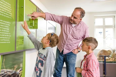
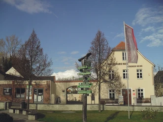
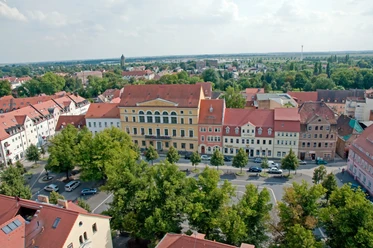
The path begins at the forecourt of Burg Düben, first mentioned in the year 981, whose walls have housed the Landscape Museum of the Düben Heath since 1953. This is how you leave the town through the symbolic gate of the Düben Heath over the Mulde Bridge. Right at the beginning of the route, the view rests on the Mulde and the backdrop of Burg Düben behind it.
On the left, the Altenhof, an old farm colony, is passed. If you let your gaze wander, the Red Bank becomes visible to the right of the path. The steep slope, up to 15 meters high, was formed by deposits of leached alum earth, which was mined here from the 16th to the 19th century. Turning your gaze, you see the district of Schnaditz with its castle and the 29-meter-high defense tower. At the former Maresch estate, an old three-sided farmstead, rural idyll prevails. Peacefully grazing cows and all kinds of feathered creatures can mostly be observed here.
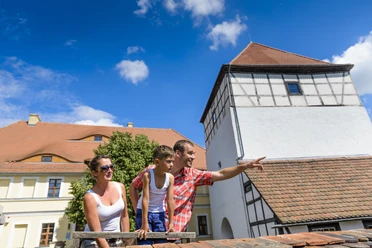
The next highlight is the small, quiet castle park of Schnaditz. There, the rare pyramid oak can be admired, and in spring, thousands of crocuses greet the visitor. At the park's exit stands Schnaditz Castle with its eight-century-long history. A plaque at the castle entrance tells some of it. You can visit the building and experience the view from the tower by prior arrangement. The nearby castle pond with its artesian well is charming. The artesian wells have special significance around Bad Düben. Knowledgeable town guides can provide information about this. A stately chestnut tree with a cozy round bench invites you to rest and linger.
Behind Schnaditz, field edges and a variety of trees and shrubs line the path before you meet the Naschkau sheep farm. As everywhere sheep live, sweet little lambs call out around Easter time. The path now leads through a wetland with its special flora and fauna toward Wellaune. Here, history meets us again. A memorial stone commemorates Hans Kohlhase and the beginning of the Kohlhaas disputes in 1532, which kept the entire region in suspense and entered world literature through Heinrich von Kleist's novella "Michael Kohlhaas." The path leads back to Bad Düben over the overgrown and scenically very appealing old Mulde dam. Here you can also make a detour to the "Former Gravel Pit" Bad Düben.
Tour information
Loop Road
Stop at an Inn
Equipment
Sturdy footwear is recommended!
Directions & Parking facilities
- Getting thereBad Düben via B2 from Leipzig or Lutherstadt Wittenberg, via B183 from Bitterfeld or Torgau.ParkingParking lot Burg Düben / Parking lot Leipziger StraßePublic transportation
- see www.mdv.de
- Bus 196: Leipzig-Bad Düben
- Bus 210: Delitzsch-Bad Düben
- Bus 232: Eilenburg-Bad Düben
- HP Bad Düben, Lutherstraße or Paradeplatz
Additional information
Dining and overnight accommodation options:
Burgschänke Goldener Löwe in Bad Düben (Tel. 034243-2860)
Hotel National in Bad Düben (Tel. 0342432869900)
Literature
Author
Verena Daser
Organization
LEIPZIG REGION
License (master data)
Verena Daser

Author´s Tip / Recommendation of the author
Make a detour on the way from Wellaune to Bad Düben to the "Former Gravel Pit Bad Düben." It features a diverse animal population.
Safety guidelines
Shortly after Wellaune, you have to cross the B107.
Map
Nearby
Download GPX file