Rund-um-Leipzig hiking trail


- 20:00 h
- 87.24 km
- 242 m
- 246 m
- 98 m
- 161 m
- 63 m
- Start: Markranstädt
- Destination: Markranstädt
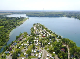
The Rund-um-Leipzig hiking trail circles the city of Leipzig with a length of about 80 kilometers. In a unique way, it allows you to experience the trade fair city of Leipzig with its diverse natural areas, history, and special features. Particularly beautiful are the sections along the shores of Cospudener and Kulkwitzer Lakes, through the floodplain forest, and along the Parthe River.
Since there are plenty of train, S-Bahn, and tram stops along the route, the circular tour can be divided into almost any number of stages and started and continued individually. Follow the color marking on the trees (white-red-white) for the route.

Good to know
Pavements
- Unknown (2%)Street (4%)Asphalt (32%)Gravel (23%)Trail (14%)Path (25%)
Best to visit
- suitableDepends on weather
Directions
The circular route can easily be started at Leipzig-Miltitz train station (near Markranstädt). The hiking trail continues clockwise towards the north. Passing Rückmarsdorf and Burghausen, you will pass the Schlosspark Lützschena and the Auwaldstation Leipzig. After about 13 km of hiking in Lützschena, there is the possibility to return to the city center by S-Bahn. Alternatively, you can continue hiking via Lindenthal and Wiederitzsch and start the return trip to the inner city from Neue Messe after about 24 km of hiking. From Neue Messe, the route goes eastwards past the districts of Mockau, Thekla, and Plaußig-Portitz. The Plaußig Nature Conservation Station can be found in Plaußig-Portitz. At Taucha, about 36 km of the total route have been reached; there is also a train connection here. East of Leipzig, Paunsdorf and Sommerfeld are passed. There is also a train connection near the route at Mölkau; about 46 km have already been covered. Further south, the path goes past Holzhausen and Meusdorf and then leads directly into the southern Leipzig New Lake District. In Markkleeberg, after about 58 km of the route, there is another S-Bahn connection for tired feet. Along the edge of the floodplain forest, the trail leads to the northern shore of Lake Cospuden and along the White Elster River a bit southwards until it is crossed. In Knauthain, after about 68 km, there is the possibility to return to the city by train. Now the route continues west of Leipzig towards Markranstädt and Lausen. When arriving at Lake Kulkwitz, the starting point at Miltitz is reached again after about 82 km.
Besides the train and S-Bahn stations, there are also several tram stops along the route to return to Leipzig city center.
Tour information
Loop Road
Stop at an Inn
Equipment
Sturdy footwear or sports shoes, weatherproof clothing, provisions, and water.
Directions & Parking facilities
- Getting there
Markranstädt is reachable by car from Leipzig Central Station via Lützner Straße.
ParkingLützschena: Schlossweg
Paunsdorf: Schongauerstraße
Markkleeberg: Ziegeleiweg
Public transportationAll starting points are easily accessible by S-Bahn or regional transport:
- Knauthain station
- Miltitz station
- Taucha station
- Mölkau station
- Lützschena S-Bahn station
- Leipzig Messe S-Bahn station
- Markkleeberg Nord S-Bahn station
Author
Verena Daser
Organization
LEIPZIG REGION
License (master data)
Verena Daser

Author´s Tip / Recommendation of the author
- Schlosspark Lützschena & Auwaldstation Leipzig
- Plaußig Nature Conservation Station
- Lead Figure Museum - Gatehouse Dölitz
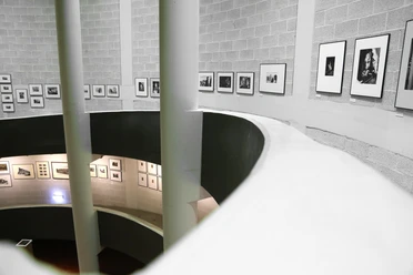
- German Photography Museum - agra-Park Markkleeberg
Nearby





Download GPX file