- 5:45 h
- 84.29 km
- 329 m
- 324 m
- 104 m
- 215 m
- 111 m
- Start: Wurzen station, Am Bahnhof 3, 04808 Wurzen
- Destination: Wurzen station, Am Bahnhof 3, 04808 Wurzen
The start and end point of this interesting route is the town of Wurzen with its numerous sights. The city silhouette with the mill towers of the former Krietschwerke, the cathedral and castle complex, and the city church arouses curiosity for more. We take the time to explore the city center - on a discovery tour through the old town with its special charm and remarkable visual appeal. Renaissance and Baroque buildings as well as newer structures with rich Art Nouveau facades together shape the flair of the town.
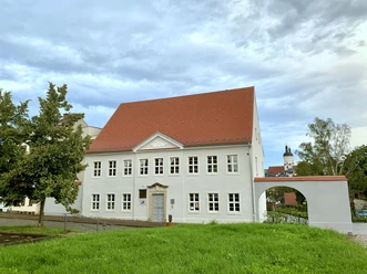
The more than 1050-year history has left many traces. The historic fabric of one of the oldest towns in Saxony with the St. Marien Cathedral and castle, the former residence of the Meissen bishops, can be explored on a walk along the "Ringelnatz Path." Dedicated to the artist Joachim Ringelnatz, it leads to the most important sights of the extensively restored old town. The most beautiful Renaissance building is undoubtedly the museum with its exhibition on the rich art and cultural history of the city and the Ringelnatz collection. After touring the city, we find peace and quiet in the parks with extensive tree stocks and the city forest, which passes quarries and connects to the excursion area of the "Hohburg mountains." On newly created and restored paths you can cycle comfortably here. A variety of excursion destinations and recreational opportunities as well as the magnificent landscape along the Mulde river with a unique, largely natural and protected animal and plant world make the Wurzener Land touristically attractive and very experiential.
Cyclists can reach the Mulde city by many routes. There are a number of long-distance bike paths crossing Wurzen. The regional bike path network is continuously expanded. In the city, the Mulderadweg intersects with the Leipzig-Elbe cycling route. This ensures optimal connection of the town to the long-distance bike path network both from north to south and from east to west, making Wurzen a central starting point for tours in the region.
Along the route of our circular bike tour through the northern part of the Geopark are some interesting points such as Canitz Park and geological landmarks like the quarries around Böhlitz, which clearly illustrate the regional importance of rock extraction. Two visitor centers of the Porphyrland Geopark are located on the way. The geoportal "Time – Change – Stone" in the Röcknitz manor house and the geoportal Museum Steinarbeiterhaus in Hohburg offer informative exhibitions about the surroundings. The traces of the ice ages can be explored at the Spielberg in Böhlitz and at the Kleiner Berg near Hohburg.
More about the cycling routes in the Leipzig region: www.leipzig.travel/radfahren

Pavements
- Street (15%)Asphalt (60%)Gravel (23%)Trail (1%)Path (1%)
Best to visit
- suitableDepends on weather
Directions
From Wurzen station we ride along Bahnhofstraße via Wenceslaigasse into the center. The over 1000-year-old cathedral town invites you here to sightseeing with various places to stop for refreshments.
Next, we go north along the city park towards Nischwitz (4.5 km).
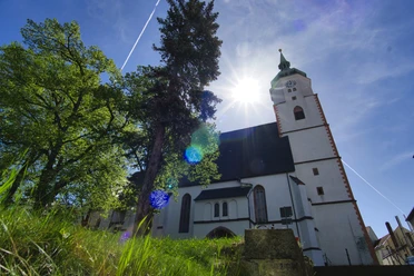
From the bike path, we turn left towards the town center. Here we can make a detour to the restored church and the playground. Near the church is also one of the most beautiful and magnificent Rococo castles in Saxony.
We continue northwards to Canitz (7.0 km).
There we find an attractive rest area, the Canitz Nature and History Park. Here you can experience nature in harmony with Saxony's history and discover the everyday life of our ancestors from the Stone to the Slavic age. Depending on the season, the theme gardens (including the fragrance, herb, organic, and rose gardens) are always inviting. In the center of the Canitz park, a museum (settlement history, nature conservation, drinking water extraction) can be visited.
We continue to follow the bike path northwards and then turn right onto "Kollauer Straße" in Thallwitz (11.0 km).
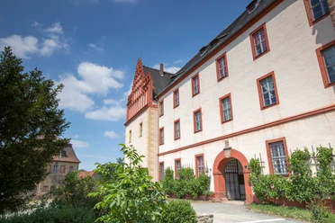
Here we have the opportunity to explore the garden of the Thallwitz Renaissance castle. Very close is a bike rest area with numerous information about the place and its surroundings.
After the church, we turn left, then right onto "Am Teich" street. Via "Im Ilsental" street we reach Böhlitz (15.5 km).
In the village of the stone worker industry, there is a thematic rest area in the town center. Böhlitz also has an outdoor swimming pool and a quarry that invite you for swimming.
We continue to follow the "Straße des Friedens" on the bike path northeast to Röcknitz (18.5 km).
There, a sign points to the geoportal "Time-Change-Stone" in the Röcknitz manor house, an adjacent geo-experience garden, and the "Fred Flintstone" volcano playground.
The bike path runs south on "Steinbergstraße." At the town exit, we turn half left onto a sand-muddy farm track.
This leads us directly into the Hohburg mountains.
(If you want to bypass the upcoming steep climb of sometimes over 15% on partly gravelled ground and the equally rapid descent, turn left after about 2 km – towards Zwochau and after another 1.5 km right onto Wildschützweg and reach Hohburg.)
We pass on our left Gaudlitzberg (219 m), on our right Burzelberg (221 m) and reach Hohburg via "Kirschberg" street (24.0 km).
In Hohburg, the "Steinarbeiterhaus" museum grants us insights into the life of stone workers. Its outdoor area features, among others, a stone crushing plant, a steam engine, and a field railway. The town offers places to eat and overnight accommodations. In summer, a detour to Kaolin Lake is worthwhile.
We leave Hohburg via Thomas-Münzer-Straße heading northeast. There the path connects to the Dahlener-Heide cycling route. We are in Thammenhain (29.0 km).
Via "Lindenstraße" and "Am Wildpark," we reach Thammenhain Castle. A walk in the idyllic castle park is recommended before leaving Thammenhain via "Am Wildpark" street towards Voigtshain. In Falkenhain (32.0 km), we turn left into "Karl-Haupt-Straße" and then right onto "Zur Siedlung" street. We pass the church and municipal office on "Karl-Marx-Straße." Via “Doktorweg” we leave Falkenhain and reach Frauwalde (36.5 km).
Here, at the mill pond, a wonderful place for rest and refreshments offers itself. The town has accommodations for overnight stays.
We continue via "Erlenweg" southwest, pass Heyda, and reach Dornreichenbach (43.0 km).
Here, an animal enclosure next to Dornreichenbach Castle invites you to linger. The tour continues through the landscape park along "An der Froschweide" street and the railway path to Mark Schönstädt (44.5 km). A detour to the idyllic forest swimming pool is worthwhile.
The route continues along "Bahnhofstraße," past the stop “Mark Schönstädt.” Via "Meltewitzer Straße," we reach Kühren (48.0 km). We then turn left onto "Schulstraße," cross the main street, and can rest at the "Elefantenbrunnen" fountain. The ride continues along "Mühlgasse;" shortly before the town exit, we turn right onto a farm track. After another 3 km, we reach Mühlbach (52.0 km).
Here are the buildings of the oldest preserved sugar factory in Germany. A bike rest area with information about the factory and a playground invites you to linger.
Along "Am Haselbruch" street, we go past Mühlteich and reach Burkartshain. From "Diesterwegstraße," we turn right onto "Fremdiswalder Straße" and keep right towards Pyrna (56.0 km).
A detour to the 12-meter-high round tower, donated in 1911 by the Burkartshain lord, is a must. Rebuilt in 1986, the small lookout tower offers a beautiful view over Wurzener Land — towards Wurzen, Trebsen, the Wermsdorf forest, and on clear days as far as Oschatz Collm. At the tower's foot is a generously designed bike rest area.
We continue on “S 47” street and reach the “Mulderadweg” via "Pyrnaer Straße." We follow it towards Wurzen to Dehnitz (65.5 km).
We ride along “Dorfstraße” towards the widely visible landmark, the 19 m-high Bismarck tower, built in 1908, and the Wachtelberg.
On Sundays and holidays, you can enjoy the view of Wurzener Land during opening hours. Inside, the Bismarck tower houses a photo exhibition informing visitors about the tower's construction and the protected plants in the surroundings. As early as 1911, the entire Wachtelberg was placed under nature protection, making it one of the oldest protected areas in Germany.
The village Dehnitz offers attractive places to eat and overnight accommodations. The tour continues along the “Am Wachtelberg” path to behind the new housing block. Here, we turn left onto a narrow cycling/walking path, which leads over the Lache directly to a ferry. We cross the Mulde by ferry and are now in Schmölen (66.0 km).
Coming from "Fährstraße," we turn right onto "Am Schwarzwasser" street and pass on the right the St. Ursula chapel and the Schmölen manor house (an original water castle). After about 300 m, "Am Schwarzwasser" street splits. Before the small grass island, we keep left and follow the street to the federal road “B 107.” After crossing B 107, we follow "Am Berg" street. At the second junction, we turn left into "Altenhainer Straße." This street leads us to Planitz Forest, the second large forest area of Wurzener Land. Here, according to signs, we turn right towards the forestry estate "Waidmannsheil" (67.5 km).
The cozy barbecue hut or the sunny terrace offer a wonderful place to stay.
The path continues through the forest to "Leulitzer Straße." We turn right here and reach Bennewitz after about 2 km (70.0 km).
In the town center, we can relax at the fountain in front of the municipal administration. Bennewitz also offers a number of places to eat and accommodations.
The ride continues on the bike path 50 m left of the municipal administration to "Leipziger Straße." We follow this to Deuben. Via "Püchauer Straße" we reach Grubnitz. Here the route passes through the Mulde foreland over the Mulde river and canal bridge, with a wonderful view of the Wurzen silhouette, marked by mill, castle, and cathedral towers. On the western edge of Wurzen, we ride on bike and farm paths following bike path signs back to Wurzen. Along the way, we pass the Gurasee and the "Dreibrücken" outdoor swimming pool. After 77.0 km, we reach Wurzen station.
Tour information
Loop Road
Stop at an Inn
Equipment
Bicycle helmet, rain and sun protection, provisions and water, bicycle lighting at night.
Directions & Parking facilities
- Getting there
By car via the A 14 Halle-Leipzig-Dresden
- Exit Grimma B 107 (17 km)
- Exit Leipzig-East B 6 (19 km)
ParkingFree P+R parking spaces are available at Wurzen station.
Public transportationWurzen station can be easily reached with the S-Bahn line 4 from Leipzig.
Additional information
- More about the cycling routes in the Leipzig region: www.leipzig.travel/radfahren
Author
Christina Witt
Organization
LEIPZIG REGION
License (master data)
Christina Witt

Author´s Tip / Recommendation of the author
Ferry operation of the Dehnitz ferry:
March to October Tue-Sun 11 a.m. to 8 p.m.
November to February (if Mulde river is ice-free) Wed-Sun 11 a.m. to 8 p.m.
Follow the Mulderadweg bike path from the starting point of the route "Wurzen station" up to the "Dreibrücken" open-air swimming pool.
The way to the station is signposted here.
In Wurzen city center there is a connection to the Leipzig-Elbe cycling route as well as to the Mulderadweg.
E-bike charging stations:
Wurzen: Bike shop at the market, Tourist Information
Lossetal: At the lime tree in Hohburg