Hike from Eilenburg to the Bobritz Dam


- 2:15 h
- 9.59 km
- 7 m
- 7 m
- 100 m
- 105 m
- 5 m
- Start: Eilenburg, station
- Destination: Eilenburg, station
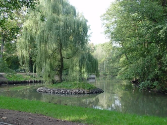
The Bobritz Dam, which is also partly called the Kollau Weir, is a popular destination for hikers and cyclists and can be reached from Eilenburg City Park via the former planet hiking trail. Here, for over 300 years, the Mühlgraben has branched off from the Mulde. Both flow around Eilenburg city center like an island and then reunite. Not only the nature, but also the water management structure, which also has a fish ladder, is remarkable.

Good to know
Pavements
- Street (10%)Asphalt (39%)Gravel (7%)Trail (30%)Path (14%)
Best to visit
- suitableDepends on weather
Directions
- The hike starts at the station in Eilenburg. Southeast out of town, the railway tracks are crossed and then you walk a bit along the Mehlgraben. The path continues south to the junction of the Mühlgraben and the united Mulde. Then the path continues north along the Mulde, passing the Bürgergarten Eilenburg. After crossing the railway tracks again, a loop is made through the town of Eilenburg before returning to the station.
Tour information
Loop Road
Stop at an Inn
Equipment
Sturdy footwear, provisions and water if needed.
Directions & Parking facilities
- Getting there
From Taucha/Leipzig via the B 87
From Mockrehna/Torgau via the B 87
From Bad Düben via the B 107
From Wurzen via the B 107
From Krostitz/Delitzsch via the S 4
ParkingEilenburg: stationPublic transportation- Train: Eilenburg station
Author
Verena Daser
Organization
LEIPZIG REGION
License (master data)
Verena Daser

Author´s Tip / Recommendation of the author
- City park & zoo
- Bobritz Dam
- Bürgergarten Eilenburg
- Eilenburg City Museum
- Church of St. Nikolai & Sauer organ
- Castle grounds & Heinzelmännchen observation hill
Nearby





Download GPX file