Course 7 - On the way in the water city Leipzig


- 2:30 h
- 8.47 km
- 5 m
- 8 m
- 105 m
- 110 m
- 5 m
- Start: Stadthafen Leipzig, Schreberstraße 20
- Destination: Stadthafen Leipzig, Schreberstraße 20
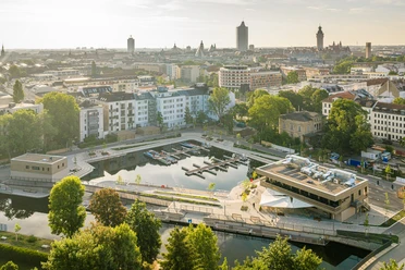
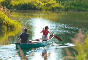
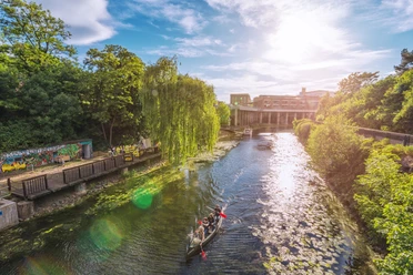
Where factories and workshops used to be, today you can admire renovated industrial architecture and artist and scene districts from the water. If you don’t own your own canoe, you can rent a boat at one of the many rental stations or comfortably discover Leipzig from a surprisingly different perspective on the passenger ship.
Course 7 can also be paddled as a circular route by canoeists. For this, the boat must only be carried around the dividing weir Großzschocher at the clubhouse of the Leipziger Kanu-Club e. V.

Good to know
Best to visit
- suitableDepends on weather
Directions
- START: 0.0 km Stadthafen Leipzig
Boarding/disembarking at the pier, parking available.
- 0.8 km Mouth of Elsterflutbett
Danger to life at the Palmengarten Weir! Keep your distance! Turn left
- 1.7 km Racecourse
Landing stage at the racecourse, access via Rennbahnweg, parking available
- 2.2 km Split of Pleiße and Elsterflutbett
Keep right and follow the Elsterflutbett upstream
- 4.4 km Großzschocher dividing weir
Danger to life at the weir! Portage to the right above the training course past the clubhouse of the Leipziger Kanu-Club e.V., portage site
- 4.5 km Stadtelster
Continue downstream on the Stadtelster. Watch out for obstacles on the training course!
- 6.9 km Karl Bridge (Industriestraße)
Pass the left turn to Karl-Heine Canal (course 2); continue on the Stadtelster
- 7.9 km Turnoff Kleine Luppe
Pass turnoff Kleine Luppe, continue on the Stadtelster towards Klingerhain Bridge
- 8.1 km Mouth of Elsterflutbett
Danger to life at the Palmengarten Weir! Keep right! Continue straight under Peterssteg into the Elstermühlgraben
- FINISH: 8.9 km Stadthafen Leipzig
Boarding/disembarking at the pier, parking available
Tour information
Stop at an Inn
Equipment
Waterproof transport bag, rain and sun protection, provisions and water.
Directions & Parking facilities
- Getting there
Motorway connections:
A9 (Berlin–Munich) – approx. 13 km
A14 (Magdeburg–Dresden) – approx. 12 km
A38 (Göttingen–Leipzig) – approx. 11 km
ParkingDue to renovation work, there are currently no parking spaces directly at Stadthafen. We recommend travelling by public transport, bicycle or on foot.
If no free parking spaces are available on the adjacent streets, the following paid alternatives are possible:
Arena Leipzig car park – approx. 650 m away
Parking areas at Red Bull Arena – approx. 1.1 km away
Public transportationTram stops:
Westplatz (lines 1, 2, 8, 14) – approx. 300 m away
Waldplatz (lines 3, 4, 7, 15) – approx. 350 m away
Train stations:
Leipzig Hauptbahnhof – approx. 1.5 km away
Markt (S-Bahn station) – approx. 1.2 km away
Additional information
Facts about course 7
Difficulty level: easy
Length: approx. 8.9 km
Locks: none
Portage: 1x for canoe circular tour below dividing weir Großzschocher
Fully usable for: canoe
Partially usable for: LeipzigBoot or water-adapted boats / rowboats / passenger shipping - Elstermühlgraben, Stadtelster downstream below Pistorissteg / height Hüfferstraße, Elsterflutbett
More water hiking routes and information about the tourist water network in the Leipzig Neuseenland can be found at www.gewaesserverbund.de.
Author
Franziska Tiedtke
Organization
LEIPZIG REGION
License (master data)
Franziska Tiedtke

Author´s Tip / Recommendation of the author
- You pass under the Sachsen Bridge, a popular meeting point in Leipzig. Don't miss the detour into the Karl-Heine Canal to enjoy a little ice cream break.
Safety guidelines
Safe and correct navigation on the waters: Water hiking instructions