Course 1a - White Elster between Pegau and Leipzig

- 7:00 h
- 27.45 km
- 3 m
- 22 m
- 105 m
- 127 m
- 22 m
- Start: Pegau, Schützenplatz
- Destination: Leipzig, Stadthafen
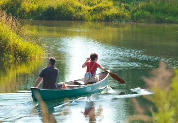
The White Elster is less turbulent between Pegau and Leipzig.
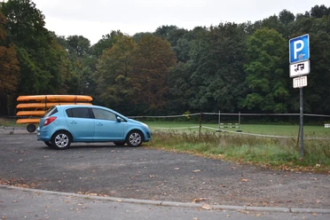
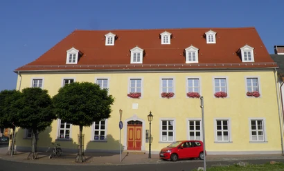
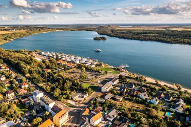
The White Elster flows through the historic old town of Pegau, known among other things for its charming Renaissance town hall and the St. Laurentius Church with the tombstone of Margrave Wiprecht von Groitzsch and its Kreutzbach organ. The boat dock at Pegau's Schützenplatz offers two large covered rest areas and several caravan parking spaces. From here, experienced canoeists can start the approximately 27-kilometer-long water route towards Leipzig.
On this route, portaging the boats at three weirs is still necessary, but the beauty of the largely untouched floodplain landscape makes this paddling trip an unforgettable experience.

Good to know
Best to visit
- suitableDepends on weather
Directions
- START: 27.5 km Pegau
Entry possible at Schützenplatz (at normal water level behind the weir crest under the road bridge), parking available for cars
- 21.0 km Settling basin Kleindalzig
Caution on entry! After exit, small rapids, from approx. 200 m before the basin the White Elster runs to Hartmannsdorf in an artificially created riverbed around the former Zwenkau open-pit mine.
- 17.9 km Zitzschen
Bridge with small rapid.
- 13.0 km Drop stage Hartmannsdorf
Caution, danger to life, 3 m high storm weir! Portage left in time shortly after the S 186 bridge to Knautnaundorf, possibility to launch behind the weir at the concrete ramp. Caution, slippery concrete banks when wet!
- 12.9 km Hartmannsdorf
Entry point for half-day trip at concrete ramp below the weir, parking available for cars. Caution, slippery concrete banks when wet!
- 10.4 km Distributor weir Knauthain
Caution weir installation! The weir is passable with open gates. The weir is closed at high water – no navigation. Danger to life! Last exit before nature priority area Zschocherscher Winkel. No further navigation during the special protection period.
***Nature priority area Zschocherscher Winkel: To protect this valuable natural area, please refrain from navigating during the protection period from February 15 to May 15 and observe the “10 rules for navigating flowing waters.”***
- 9.8 km Bridge Ritter-Pflugk-Straße
Caution current! Beginning of the old riverbed of the White Elster.
- 7.1 km Weir Großzschocher
Caution weir installation! Portage on the right. Danger to life, do not use the fairway in the middle! Keep distance from the backflow of the weir, end of nature priority area.
- 7.0 km Sports club Südwest e. V.
Caution, larger area with stronger current!
- 6.0 km Bridge S 46
Smaller current, keep middle position.
- 5.5 km Brückenstraße / junction
Possible to launch during the special protection period, parking available for cars.
- 4.7 km Division weir Großzschocher
Caution weir installation, danger to life! Strong current, please pass at a sufficient distance along the left bank.
- 4.6 km Portage site Elster floodbed
Portage into the Elster floodbed above the training route past the Leipziger Kanu-Club e.V. club grounds, dock available.
- 1.7 km Horse racetrack
Dock at the racetrack. Access via Rennbahnweg, parking available.
- 0.8 km Mouth Elstermühlgraben
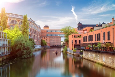
Caution danger to life at Palmengarten weir! Keep distance, turn right under the Peterssteg into the Elstermühlgraben.
- FINISH: Stadthafen Leipzig
Exit at the dock, parking available.
Tour information
Stop at an Inn
Equipment
Waterproof transport bag, rain and sun protection, provisions and water.
Directions & Parking facilities
- Getting there
By car: Follow B2 to Leipziger Vorstadt in Pegau.
By bike: Past Elster-Pleiße floodplain forest, Cospudener See and Zwenkauer See. Then continue via Mausitz along Carsdorfer Str. into Pegau.
Public transportationSchützenplatz, Pegau
TRAIN: HP Pegau
BUS: HP Pegau, Kirchplatz or Elsteraue
Stadthafen, Leipzig
TRAM: HP Leipzig, Westplatz (Leipzig Main Station - approx. 1.5 kilometers away)
By public transport: Take RB13 or RE12 to Pegau station
Additional information
Facts about course 1a
Difficulty: for experienced paddlers
Length: approx. 27.5 km
Locks: none
Portages: 3x from Pegau entry point, 2x from Hartmannsdorf entry point (boat trolley helpful)
Fully usable for: canoe (downriver navigable)
Partially usable for: LeipzigBoat/water-adapted boats (Elster floodbed, Elstermühlgraben), rowing boat (Elster floodbed, Elstermühlgraben) / passenger shipping (Elstermühlgraben, Elster floodbed)
More water hiking courses and information on the tourist water network in the Leipzig New Lakes District can be found at www.gewaesserverbund.de.
Author
Franziska Tiedtke
Organization
LEIPZIG REGION
License (master data)
Franziska Tiedtke

Safety guidelines
Caution, danger spots!
- Drop stage Hartmannsdorf: 3 m high storm weir, portage the boat in time before the weir
- Distributor weir Knauthain: The weir is only passable with open gates, otherwise portage the boat!
- Weir Großzschocher: Notice of the weir is shortly after the bridge in Knauthain, therefore already far before the weir, no further signage to the weir in Großzschocher follows. Portage on the right at the weir and keep distance from the backflow of the weir. Do not use the fairway in the middle or the boat slide.
- Division weir Großzschocher: strong current, please pass at a sufficient distance along the left bank
- Palmengarten weir: keep distance
Safe and correct on the waters: Notes on water hiking
To protect the Zschocherscher Winkel nature priority area, navigation downstream between the Knauthain weir and the bridge at Ritter-Plugk-Strasse is not permitted from mid-February to mid-May.