Route 1 - From Leipzig to Cospudener Lake

- 3:00 h
- 10.50 km
- 7 m
- 6 m
- 105 m
- 112 m
- 7 m
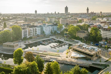
- Start: Leipzig city harbor, Schreberstraße, 04109 Leipzig
- Destination: Pier 1/Zöbigker Harbor at Cospudener Lake, Hafenstr. 23, Markkleeberg
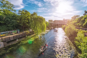
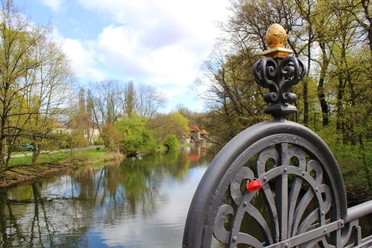
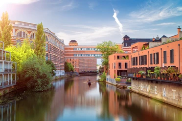
A paddling route on course 1 from Leipzig city harbor to Cospudener Lake is one of the most popular water hiking routes in and around Leipzig because it offers the paddler many different facets. Here is everything that makes the hearts of watersports enthusiasts and leisure captains beat faster: city flair on the Elstermühlgraben, park idyll on the White Elster, primeval forest feeling in the floodplain forest, Lauer Forest Lake, and the large Cospudener Lake. Since nature conservation is the top priority in the water network, the route may only be navigated with canoe, rowboat, and the specially designed Leipzig boat.

Good to know
Best to visit
- suitableDepends on weather
Directions
- START: 0.0 km Elstermühlgraben Outer Pier City Harbor
Entry/exit at the pier, parking available
- 0.8 km Mouth of Elster Flood Channel
Danger to life at Palmengarten Weir! Keep distance! Turn left
- 1.7 km Horse Racing Track
Pier at the racetrack, access via racetrack path, parking available
- 2.2 km Fork of Pleiße and Elster Flood Channel
Continue left into the Pleiße flood channel
- 3.0 km Connewitz Lock with Boat Slide
Self-service; caution at technical facilities! Please observe instructions for use! Portaging the boat is possible.
***Here begins the trip on the Pleiße through the southern Leipzig floodplain forest. To protect the valuable natural area, please observe the "10 rules for navigating waterways," land only at designated piers, and respect the minimum water depth (> 30 cm). Navigation of the Raft Canal is only permitted during the kingfisher breeding season from March 1 to September 30 daily from 11 am to 1 pm, 3 pm to 6 pm, and 8 pm to 10 pm.***
- 4.5 km Raft Canal Junction
Keep right, continue through the southern floodplain forest
- 6.7 km Fork of the Raft Canal
Keep right, after approx. 50 m underpass of bridge S46
- 6.9 km Lauer Forest Lake
Crossing to the inflow of Cospudener Lake (through the Cospuden landscape park)
- 8.3 km Cospuden Lock
Self-service, caution at technical facilities! Please observe instructions for use! Portaging the boat is possible.
- 8.6 km Cospudener Lake
For safety before continuing on the Cospudener Lake, pay attention to wind and weather conditions, landing possible on the left and right banks of the North Beach
- FINISH: 10.7 km Zöbigker Harbor
Dock available
Tour information
Stop at an Inn
Equipment
Waterproof transport bag, sun and rain protection, provisions and water, swimwear.
Directions & Parking facilities
- Getting there
Motorway connections to Leipzig city harbor:
A9 (Berlin–Munich) – approx. 13 km
A14 (Magdeburg–Dresden) – approx. 12 km
A38 (Göttingen–Leipzig) – approx. 11 km
ParkingParking is available (paid) both at Leipzig city harbor and at Zöbigker/Cospudener Lake harbor.Public transportationThe city harbor is located in the Leipzig city center near the Westplatz stop (TRAM 1, 2, 8, 14). The distance to the main train station is approx. 1.5 kilometers.
You can reach Zöbigker/Cospudener Lake harbor by bus 107 (stop Zöbigker, Schmiede) or by S-Bahn (stop Markkleeberg-Großstädteln).
Tram stops:
Westplatz (lines 1, 2, 8, 14) – approx. 300 m away
Waldplatz (lines 3, 4, 7, 15) – approx. 350 m away
Train stations:
Leipzig Main Station – approx. 1.5 km away
Markt (S-Bahn station) – approx. 1.2 km away
Additional information
Facts about route 1
Length: approx. 11 km, continuously navigable
Locks: 2, passenger shipping has priority
Portaging: not necessary
Navigability: upstream and downstream
Fully usable for: canoe / Leipzig boat or waterway-adapted boats
Partially usable for: rowboat (Elster and Pleiße flood channels, Pleiße, lakes) / sailboat (lakes) / passenger shipping (lakes, Elstermühlgraben, Elster and Pleiße flood channels)
Navigation of the raft canal is only allowed during the kingfisher breeding season from March 1 to September 30 daily from 11 am to 1 pm, 3 pm to 6 pm, and 8 pm to 10 pm.
Further water hiking routes and information about the tourist water network in the Leipzig Neuseenland can be found at www.leipzig.travel/wasserwandern.
Author
Franziska Tiedtke
Organization
LEIPZIG REGION
License (master data)
Franziska Tiedtke

Safety guidelines
- Palmengarten Weir: Danger to life! Keep distance at all times.
- Use of locks: Please observe instructions for use!
- Southern floodplain forest: To protect the valuable natural area, please observe the 10 rules for navigating waterways and land only at designated piers, also respect minimum water depth (> 30 cm).
Safe and correct navigation on the waters: Information on water hiking
During breeding seasons from March to September, navigation of the raft canal is only allowed daily from 11 am to 1 pm, 3 pm to 6 pm, and 8 pm to 10 pm.
Portaging of boats is not necessary on this route due to locks.