Circular hiking trail Trages spoil tip


- 2:00 h
- 8.28 km
- 85 m
- 85 m
- 150 m
- 232 m
- 82 m
- Start: Teichstraße 37/1, 04579 Rötha OT Espenhain
- Destination: Teichstraße 37/1, 04579 Rötha OT Espenhain
The Trages spoil tip was created in the 1930s and 1940s from overburden material of the Espenhain open-pit mine. Reforestation began as early as the 1950s. The 70 m high and 2 km long spoil tip lies between Espenhain, Mölbis, Trages, and Thierbach. The nature trail is about 8 km long.
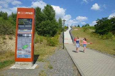
The hill is characterized by erosion channels on the west side and ecologically significant biotopes in the spoil forest. The 8 km circular hiking trail offers an ideal terrain for nature and hiking enthusiasts on the spoil tip. Information boards provide interesting facts about animals, plants, habitats, the erosion landscape, the spoil forest, and the landslides in the 1950s.
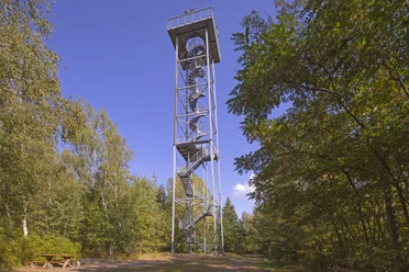
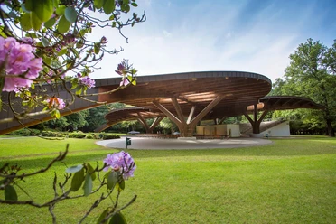
Several viewpoints offer insights into the Leipzig Neuseenland. A 33-meter-high observation tower opened in February 2002 allows distant views to the Ore Mountains ridge and the Geisel valley. A shelter near the southern tip invites you to rest.

Good to know
Pavements
- Asphalt (38%)Gravel (18%)Trail (35%)Path (8%)
Best to visit
- suitableDepends on weather
Directions
The starting point of the hike is the parking lot of the Trages spoil tip in Mölbis, passing the Marien Church. Then follow Kretschmar Street to the beginning of the forest area. From the Ziegelteich pond, continue to the northern viewpoint. Halfway through you will reach the first key point: the viewing platform, which offers an impressive view of the surrounding landscape. Going counterclockwise, follow the circular trail past the northern viewpoint back to the starting point of the hike.
Tour information
Cultural Interesting
Loop Road
Equipment
Sturdy footwear or sports shoes, provisions and water if needed
Directions & Parking facilities
- Getting there
Car to Rötha OT Mölbis
ParkingStraße des Friedens 34, 04571 Rötha OT Mölbis (opposite the orangery)
Public transportationBus 276: Borna - Leipzig (stop Mölbis - Espenhain)
Additional information
https://halde-trages-wandern.de/
Author
Verena Daser
Organization
LEIPZIG REGION
License (master data)
Verena Daser

Author´s Tip / Recommendation of the author
- Observation tower Trages spoil tip
- Bucket-wheel excavator
- Orangery Mölbis
Nearby


Download GPX file